Bash Kyungyut village
- 28-12-2024, 22:25
- Villages
- Elnur Nəciyev
The next village along the Albanian route in the Shaki district is the village of Bash Kyungyut, located on the bank of the Kyungyut River*, at the foot of Mount Gyzylgaya. The village is surrounded by the Greater Caucasus Mountains from the north, the village of Bideyiz from the south, Bash Kaldak from the east, and the village of Oraban from the southeast.
The Kyungyut River flows east of the village. Floods usually occur in the river toward the end of summer and the beginning of autumn. A smaller river named Qarachay flows through the village itself. Bash Kyungyut is the administrative center of the same-named territorial unit, which also includes the village of Bideyiz. Near Bash Kyungyut, along the upper stream of the Kyungyut River, there is a mountain called Boyundagh, with an elevation of 2191 meters. The oronym (place name) is formed from the words boyun (mountain pass) and dagh (mountain), meaning “mountain with a pass.”
Within the territory of Bash Kyungyut lies the medieval Kyungyut Fortress. The second component of the toponym is associated with the Turkic-speaking Kyungyut tribe, which took part in the Mongol invasions in the 13th century. This is an ethnotoponym. The oikonym means “Upper Kyungyut village.” The people who migrated from this village founded the village of Ashaghy Kyungyut in Shaki. The 1856 edition of the Caucasian Calendar refers to Kyungyut as a Tatar (Turkic) village speaking the Tatar (Turkic) language within the Khachmaz region. Researchers such as Qiyasaddin Qeybullayev and Afad Gurbanov also interpret this name as belonging to a Turkic tribe.
The geologist Muhiddin Farhadoghlu associates the name of Kyungyut with Kunkend, a village mentioned in the work of Adam Mets. However, it cannot be stated with certainty that the toponym Kyungyut is a distortion of Kunkend. Another theory suggests that the name comes from Gun Qut, meaning "Sun God." The word qut is still widely used among Turkic peoples today.
According to information provided by Habil Hummetov, the imam of the mosque in Bash Kyungyut and a member of the Mollalar family, the village includes neighborhoods called Bekirler, Mekteb Qabaghi, Kheletler, Bocha, Shikhallar (Sheykh Ali family), Suvarlar, Mollalar (believed to be a lineage that migrated from the village of Mukhakh in Zaqatala), Kogushlar, Chay Qiraghi, and Ambarabad.
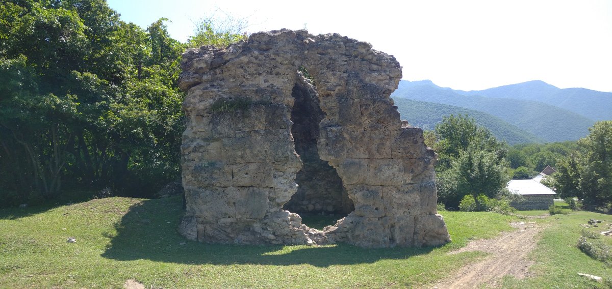
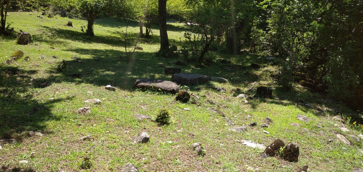
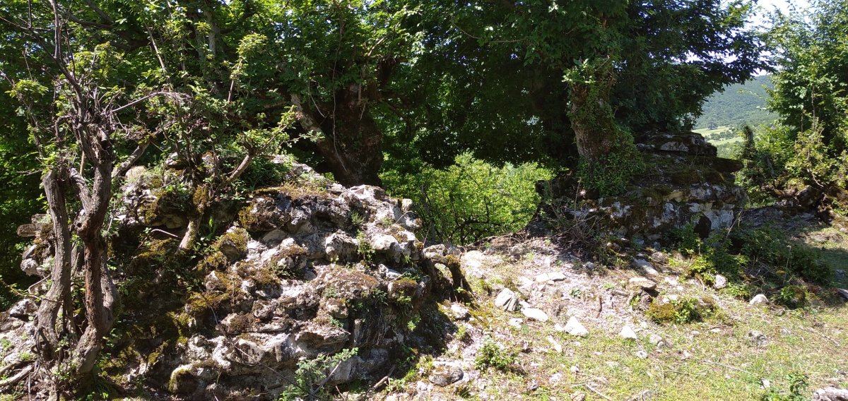
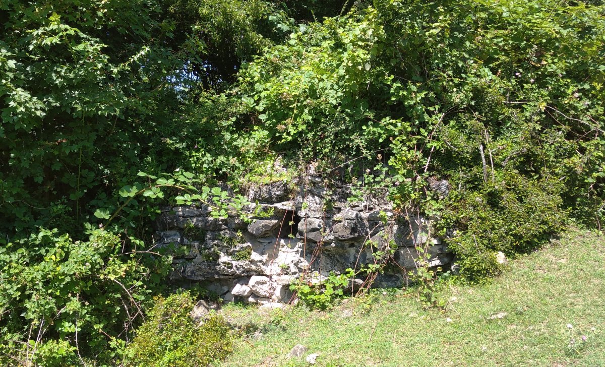
In the part of the village called Kilsedagh, above the village cemetery, are the ruins of the medieval Kyungyut Fortress, an Albanian temple, and an Albanian cemetery — all noteworthy historical monuments. One of the best-studied historical monuments in Bash Kyungyut is the fortress located on Kilsa Mountain. The initial investigation of this fortress is associated with Firudin Qadirov, who also authored a separate article on the subject. In that article, he provided detailed information on the findings of his research. According to the article, between 1964 and 1968, Firudin Qadirov, while traveling through Shaki as part of a mission to study fortification monuments in the Gabala region, had the opportunity to examine the Kyungyut Fortress.
The fortress is rectangular in shape. It is 120 meters in length and 42 meters in width. The walls and towers of the fortress are relatively well-preserved on the southern and western sides. The walls are 2.65 meters thick and vary in height from 2 to 5 meters, though their upper sections are completely destroyed. The towers are perfectly square in shape. Two of the towers on the southern side have remained relatively intact, with each side measuring 8 meters. The Kyungyut Fortress has two gate openings. The main gate is located in the southern wall. An ancient road rising from the nearby flat terrain into the fortress and the remains of two closely placed towers provide evidence for this. Although it is not possible to determine the exact shape and dimensions of the gate, the 6-meter distance between the two towers suggests that the gate was wide enough for wheeled transport to enter.
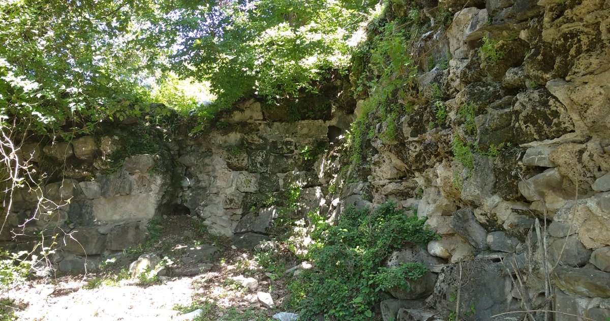
The monument is built from river stones with lime mortar. No bricks or other construction materials were used in its construction. The fortress has not retained its original form. However, based on the remnants of several arrow slits in the walls, it can be said that they were mostly built in square (40x40 cm) and in some places circular shapes. Similar slits are also characteristic of the fortress walls in the Salbir area of Gabala. The design of the towers suggests that the Kyungyut Fortress resembles simple and easily built ancient defensive fortifications. In 1968, exploratory archaeological excavations were conducted in three parts of the monument — the northwest, south, and central sectors.
As a result of these archaeological excavations, pottery fragments found in the cultural layer were identified as belonging to glazed bowl-shaped vessels widely produced in the 9th–10th centuries. The unglazed pottery shards consist mainly of pieces of jugs, pans, pots, cauldrons, single-foot vases, milk containers, and clay-based construction materials. Researcher Firudin Qadirov states that the foundation of the Kyungyut Fortress was laid in the 4th–6th centuries, and it was extensively used as a defensive fortification during the 7th–8th centuries. It was destroyed in the 11th century, either during the end of Gabala and Shaki’s independent feudal rule or during the Seljuk invasions. The main entrance gate was protected by rectangular towers on both sides. The Kyungyut Fortress is believed to date back 1300–1400 years, although this requires further investigation.
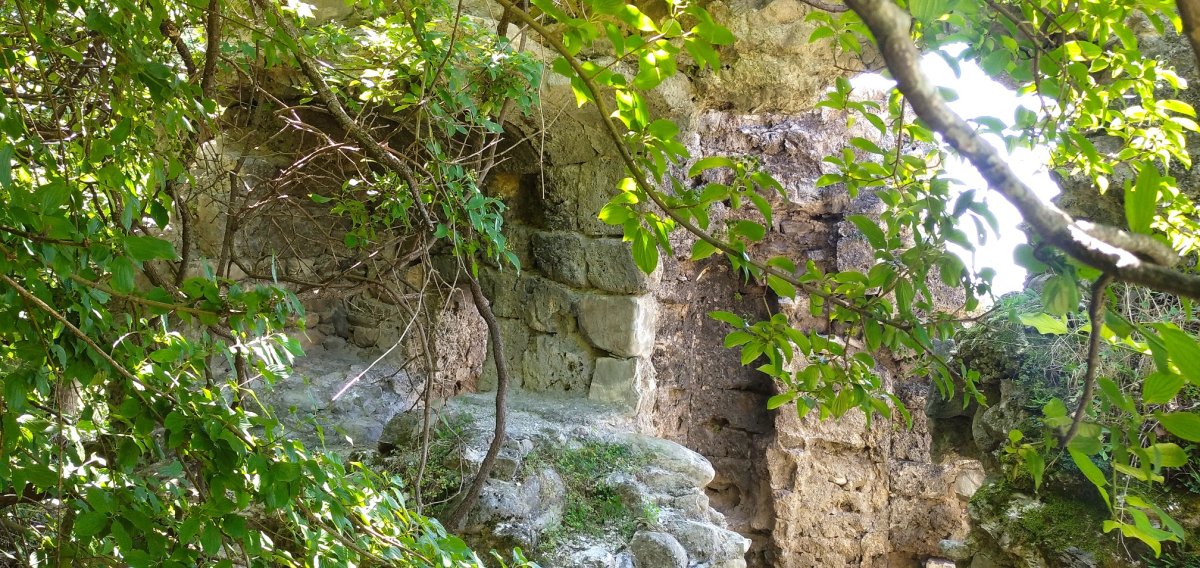
The Albanian temple located in the Kilsa Mountain area also attracts attention. There is no information about the history of this monument, nor is there any plaque indicating its protection. Researcher A. Garaahmadova assumed that this temple, located 10–12 meters east of the fortress entrance (outside the fortress), was built in the 6th–7th centuries. Its architectural style resembles that of the chapel in Orta Zayzid. However, it is somewhat larger, although its interior closely resembles that of the Orta Zayzid chapel.
Bash Kyungyut village also contains an ancient cemetery bearing witness to Albania’s Christian history. These earth graves, covered with flat river or rock stones, are common not only in Bash Kyungyut but also in Orta Zayzid, as well as in the villages of Jalut and Kerimli in the Oghuz district and other regions. Such grave types are also found in other early medieval Albanian monuments. These graves had chambers filled with soil and sometimes covered with wooden planks.
In Azerbaijani historiography, earth graves with tightly folded skeletons are considered archaeological reflections of the Yaloylutapa culture. Later, this tradition coexisted with and was followed by the jar burial culture known in regions neighboring Albania. This is seen as evidence of the unification of Albanian tribes. Among Shaki’s ancient and early medieval grave monuments, jar burials hold special importance. Although most of the jar burials found in Azerbaijan are placed horizontally, vertically placed jars have also been discovered in the Shaki region. In the South Caucasus, jar burials are characteristic of the period from the 8th century BCE to the 8th century CE.
* The Kyungyut River is a right tributary of the Ayrichay River, which in turn is a left tributary of the Ganikh River. It originates on the slopes of Mount Saylakhan at an altitude of 3200 meters. In its lower course (in the Alazan-Ayrichay valley), it is widely used for irrigation purposes.
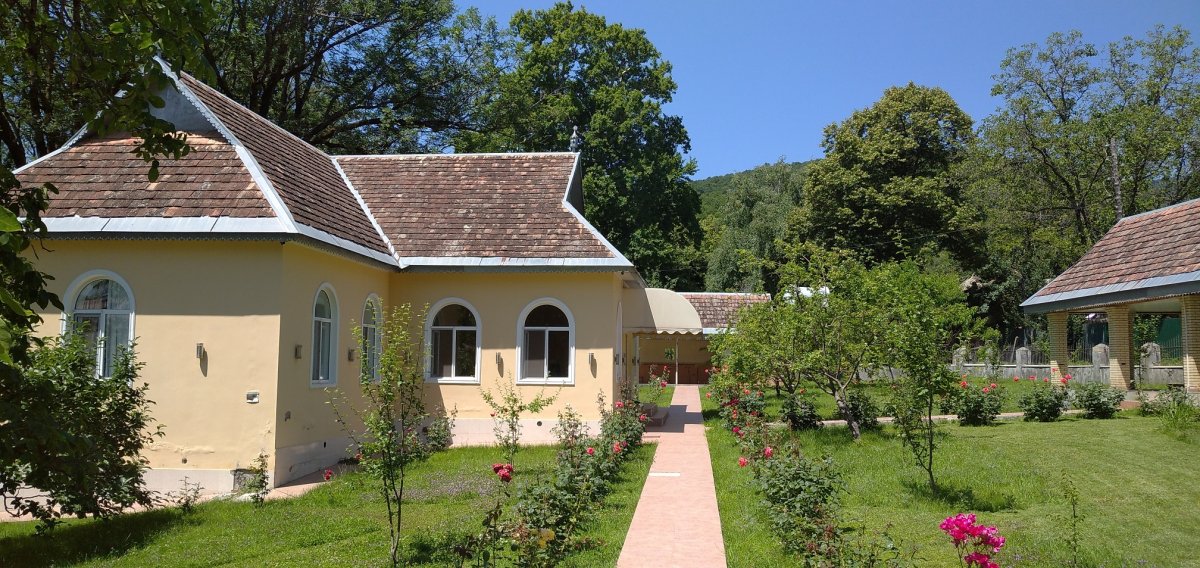
Bash Kyungyut mosque